A 7-Day Imbabura Itinerary for Travelers
The Imbabura Philosophy: Pacing and Acclimatization
The Imbabura province, recognized formally as a UNESCO Global Geopark, rewards travelers who prioritize structured pacing over rapid transit. Dedicating a full seven days to this northern Ecuadorian region allows the human respiratory system to properly acclimatize to the high Andean altitude. This measured approach significantly reduces the physiological risk of acute mountain sickness before attempting major ascents. Structuring a week in Imbabura requires strategic geographic progression: starting with low-impact valley walks before advancing toward high-altitude paramo environments and steep crater lakes. This specific pacing strategy ensures physical well-being while facilitating a more accurate understanding of the regional Kichwa heritage. Rather than rushing through surface-level market visits, a dedicated week provides the necessary time to observe local agricultural and weaving practices firsthand. For a broader geographic context regarding the surrounding topography, consult our primary guide to Nearby Attractions in Imbabura.
Logistical Data: Pacing, Elevations, and Transport
| Day | Destination | Elevation | Est. Transport Cost (from Otavalo) | Pacing / Activity Level |
|---|---|---|---|---|
| Day 1 | Otavalo Center | 2,532 m (8,307 ft) | N/A (Basecamp) | Low (Rest & Hydration) |
| Day 2 | Peguche Waterfall | 2,600 m (8,530 ft) | $0.35 (Bus) / $2.00 (Taxi) | Easy Walk |
| Day 3 | Cuicocha Lake | 3,246 m (10,650 ft) | $0.40 (Bus) + $5.00 (Taxi) | Moderate Hike |
| Day 4-7 | Imbabura Surrounds | Up to 4,000m+ | Varies by Route | High (Acclimatized) |
For detailed public transit and regional taxi routes, visit our comprehensive Transport Guide.
Day 1: Arrival in Otavalo and Gentle Orientation
Establishing a Basecamp
We highly recommend establishing Otavalo as your central hub for the week. The town boasts robust infrastructure, strategic geographic placement, and excellent dining options capable of accommodating various dietary requirements. For official municipal tourism information and local emergency contacts, reference the Alcaldía Ciudadana de Otavalo portal. Additionally, international travelers should always stay updated with the Ecuadorian Ministry of Tourism for any regional travel advisories before securing accommodations.
Altitude Adjustment & Navigation
“Take it easy on your first day. Consistent hydration and light walks are your best defense against the altitude.”
Spend your first afternoon familiarizing yourself with the town’s grid layout, walking slowly through the central plazas like Plaza de Ponchos. Keep physical exertion to a strict minimum. Focus on drinking plenty of water, consuming local herbal teas, and allowing your cardiovascular system to adapt to the 2,532-meter elevation. Dive deeper into the local customs by reading our comprehensive overview of Kichwa Culture & The Inti Raymi Festival.
Day 2 Morning: The Scenic Railway Walk to Peguche
Once you have secured a restful night, begin your second day with a gentle, highly recommended 3.3 km pedestrian route from Otavalo to the sacred waterfall area. This specific path safely follows the abandoned “Tren Ecuador” railway tracks straight north from the Otavalo Train Station. The walk takes exactly 40 minutes at a standard, leisurely pace. Following these old tracks offers clear sightlines of the surrounding mountains and rural farmland, serving as a perfect, low-impact acclimatization exercise. As you approach the site, you will cross into the protected eucalyptus forest. Remember that this specific parcel of land is deeply sacred to the local Kichwa communities. To verify operating hours before departing, review the main Cascada de Peguche Guide and check current entry guidelines on our Tickets & Tours page.
Walking Route Map: Otavalo to Peguche
Day 2 Midday: Faccha Llacta Entry and the Reloj Solar
Upon concluding the railway walk, visitors arrive at the primary entrance of the Bosque Protector. While the main natural site is technically free to access, as of 2026, the Faccha Llacta community registration desk actively asks for a specific $0.50 USD entry contribution for all international visitors. This mandatory contribution directly finances the maintenance of the deeper trail infrastructure and localized waste management systems. Immediately past the registration desk stands the indigenous solar calendar, or Reloj Solar. Local artisans constructed this functional astronomical tool entirely from regional materials, specifically adobe, tapial, bahareque, stone, and sigsig—a small, highly durable Andean bamboo native to this specific elevation. This calendar remains a precise indicator of the solstices, tracking the solar movements central to Kichwa agricultural cycles.
Day 2 Afternoon: Upper Trails and Historical Pools
Beyond the main lower viewpoint of the falls, the primary walking path splits. A right-hand fork leads upward past a designated warning sign, transitioning into a narrow, steep dirt trail. This upper route crosses directly over the top of the 18-meter waterfall, granting unobstructed panoramic views of the surrounding valley and the steep Jatun Yaku river gorge below. When navigating the Peguche trails, crossing the primary suspension bridge over the Jatun Yaku River to the right-hand side is the optimal route. Experienced local guides confirm this specific path avoids the exceptionally muddy and insect-heavy conditions prevalent on the left bank. Closer to the lower path fork, visitors can inspect the historical piscinas—stone pools utilized historically for ritual bathing—and traditional batanes, which operate as fabric washing areas. These specific stone structures exhibit distinct pre-colonial and Incan engineering influences. For complete topographical documentation, review our Trail Map & Hiking Guide.
Day 3: The Cuicocha Crater Lake Hike
By the third day, the human body typically registers sufficient acclimatization to handle rigorous, sustained physical exertion. The primary objective is the Cuicocha Crater Lake, located directly inside the active Cuicocha caldera at the foot of the dormant Cotacachi volcano at an elevation of 3,246 meters. Hiking the entire circumference of this collapsed volcano requires between 4 and 7 hours, depending strictly on individual aerobic capacity and weather conditions.
The primary trail traces the steep, jagged rim of the active Cuicocha caldera, offering direct sightlines to the two central islets located within what is known as the Lake of the Gods.
Due to the rapid barometric shifts typical at this altitude, beginning the hike by 8:00 AM is essential to avoid the dense afternoon fog that frequently compromises visibility. Travelers preferring structured logistical support can seamlessly arrange a guided private excursion to Otavalo, Cuicocha Lake, and Peguche. This ensures safe transit from your basecamp and secure, guided navigation along the exposed crater rim.
Day 4: Artisan Manufacturing in Cotacachi and San Antonio
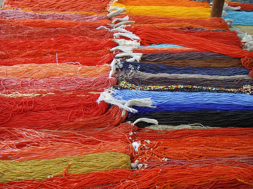
Shift the itinerary’s focus from physical exertion to the province’s specialized manufacturing sectors. A brief 20-minute drive from the waterfall area leads directly to the municipality of Cotacachi. This town operates as the undisputed epicenter of Ecuador’s leather goods production. Over 50 artisan leather shops are concentrated almost exclusively along Avenida 10 de Agosto, a central thoroughfare recognized locally as Leather Street. Here, raw materials are processed, dyed, and stitched into highly durable goods ranging from heavy-duty equestrian saddles to precision-cut jackets.
Later in the afternoon, proceed approximately 6 kilometers southwest of the provincial capital, Ibarra, to reach San Antonio de Ibarra. This specific district is globally recognized for its advanced woodworking and sculptural ateliers. These specialized workshops cluster tightly along Avenida 27 de Noviembre. Visitors can inspect the main gallery of master contemporary carver Luis Potosí, whose intricate woodwork demonstrates the precise religious and cultural motifs central to Andean art history. For a deeper look at regional production techniques, consult our dedicated resource on Local Workshops & Weavers.
Day 5: Historical Haciendas and Conservation Projects
Hacienda Pinsaquí
Located exactly at Kilometer 5 on the Panamericana Norte highway, Hacienda Pinsaquí stands as a critical historical monument in the region. Constructed in 1790, this expansive estate hosted the historic signing of the Peace and Friendship Treaty between Ecuador and Colombia. Today, its original colonial architecture remains intact. The on-site Pedro Freile Restaurant executes upscale traditional Andean meals, utilizing root vegetables and grains sourced directly from the surrounding volcanic soil.
Hacienda Zuleta
Situated in the adjacent Angochagua valley, the 4,000-acre Hacienda Zuleta dates back to the late 16th century. Beyond its primary status as a working dairy farm, the property operates the critical Condor Huasi rehabilitation project. This specific biological initiative allows guests to safely observe endangered Andean Condors at close range and supports the conservation of wild Spectacled Bears on the estate. The project aligns seamlessly with the regional environmental goals outlined in our Conservation & Environment overview.
Day 6: The Inti Raymi Context and Cultural Regulations
To fully grasp the socio-religious importance of the Imbabura province, visitors must understand the mechanics of the Inti Raymi festival. The sacred purification baths, known formally as Armay Tuta, peak precisely at midnight on the night of June 22nd, continuing directly into the early hours of June 23rd. During this strict timeframe, local indigenous yachags, or shamans, lead the Kichwa community directly into the frigid waters of the main waterfall. This ritual act is designed to spiritually cleanse the participants before the demanding agricultural dances commence in the town squares. For an exhaustive historical breakdown of this event, read our post on Understanding the Andean Inti Raymi Traditions.
Outside of the specific festival dates, the site remains a highly protected ecological and spiritual zone. Visitors are expected to comply with specific behavioral mandates to preserve the structural and auditory integrity of the forest. The local Kichwa administrative bodies enforce strict regulations, including:
- Noise Regulations: Maintaining low decibel levels to respect the ongoing spiritual practices and local avian wildlife nesting zones.
- Waste Disposal: Utilizing designated sorting bins at the Faccha Llacta entrance to prevent chemical contamination of the Jatun Yaku river.
- Drone Flight Restrictions: Securing explicit, written prior authorization from the community council before launching any aerial recording devices.
Review the complete Visitor Rules & Guidelines to ensure your presence does not disrupt the ongoing conservation efforts or disrespect the foundational Kichwa traditions.
Day 7: Departure Logistics and Cayambe Gastronomy
The final day involves a calculated return to the capital city of Quito or onward transit to the Mariscal Sucre International Airport. While interprovincial cooperatives like “Los Lagos” and “Otavalo” operate buses leaving the Otavalo bus terminal frequently—charging around $2.50 to $4.00 USD for the approximately 2-hour drive to Quito—securing a direct private transfer ensures a highly efficient departure. En route southward along the Pan-American Highway, travelers traditionally execute a specific logistical stop in the agricultural town of Cayambe.
Cayambe is synonymous globally with a specific culinary export: the bizcocho. Stopping at a dedicated Fábrica de Bizcochos allows departing visitors to consume these dense, savory biscuits exactly as they are pulled from massive wood-fired ovens. The standard local preparation pairs the hot bizcochos with queso de hoja—a stringy, unpasteurized cheese wrapped tightly in thick achira leaves—and a heavy layer of manjar de leche, a thick caramelized milk spread. Opting for a comprehensive Otavalo and Cayambe tour often integrates this specific tasting stop directly into the final transfer itinerary. For broader security context regarding safe transit along the Pan-American Highway during your departure, read our latest operational analysis on Is Northern Ecuador Safe for Tourists?.