The Vibe
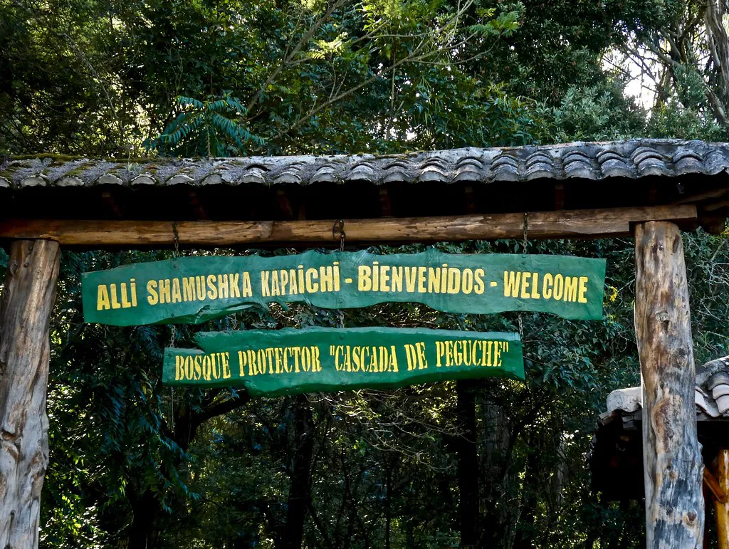
Hiking through the Bosque Protector (Protected Forest) of Cascada de Peguche requires an appreciation for both gentle nature walks and high-altitude physical exertion. The moment you step past the community registration desk, the ambient temperature drops noticeably. The air grows heavy with the scent of towering eucalyptus trees and the distant, constant roar of rushing water. This is a deeply tranquil environment that honors its ecological boundaries and its sacred Kichwa heritage, offering a network of pathways that intersect ancient spiritual sites, thermal springs, and shaded woodland.
The local Faccha Llacta community maintains these routes, requiring a strict $0.50 minimum contribution at the entrance to fund the ongoing upkeep of the bridges, ziplines, and cobblestone paths. You can find more details about entrance protocols on our tickets and tours page. The trail system is deliberately structured to accommodate a wide spectrum of physical abilities. The primary thoroughfare provides a highly accessible, flat stroll to the main 18-meter waterfall. Branching dirt paths, however, challenge hikers with steep, root-covered ascents leading to secondary cascades and high-ridge caves.
Navigating these upper routes demands respect for the altitude. The average elevation of the hiking trails inside the protected forest sits at exactly 2,592 meters (8,503 feet) above sea level. This metric makes the stair climbs taxing for unacclimated visitors. Whether you are navigating slippery ridge climbs or standing on a mist-drenched suspension bridge, the trails here deliver a concentrated dose of Imbabura’s wild geography. For travelers wanting to pair this hike with a broader regional exploration, booking a private guided day trip from Quito often removes the logistical friction of navigating between the trailheads and the nearby highland markets.
Category 1: The Main Route & Key Landmarks
The core hiking experience begins on a highly accessible, flat cobblestone path that spans 1.5 kilometers (0.9 miles) from the community entrance gate. This gentle route takes roughly 20 to 25 minutes to complete at a leisurely pace, functioning as an ideal warm-up before tackling the steeper secondary trails. Almost immediately upon entering the forest, hikers will encounter two distinct cultural landmarks that set the tone for the trek.
The first is the ancient Calendario Solar (Solar Clock), a circular stone structure used historically to track solstices and agricultural cycles. A few dozen meters further, the path passes the heavily marked Árbol de la Fertilidad (Fertility Tree). Local custom dictates that visitors hug the massive trunk of this specific tree to bring good fortune before continuing their walk toward the falls. The Alcaldía de Otavalo frequently highlights these specific sites as crucial introductory elements to understanding local indigenous cosmology.
For visitors organizing their own logistics, reaching this primary trailhead is straightforward. Hikers can catch a red public bus operated by the Cooperativa Imbaburapac, departing every 30 minutes from the main Otavalo terminal. The 15-minute ride drops passengers right near the trail entrance and costs exactly $0.35 to $0.50 per person. We cover all terminal departure points and taxi alternatives in our comprehensive transport guide.
Category 2: The Upper Trail & Suspension Bridge
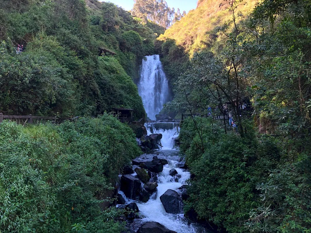
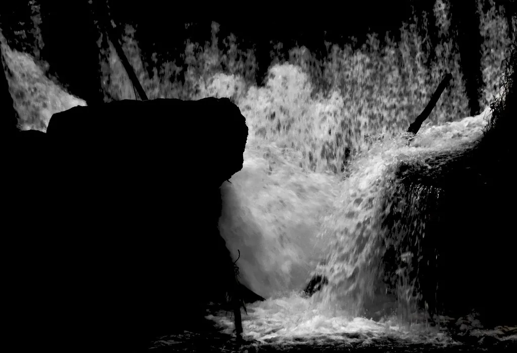
As the cobblestone path terminates at the viewing platform for the main 18-meter cascade, the topography changes dramatically. The water feeding the falls originates miles away as the Peguche River, but immediately after this massive plunge, locals rename the waterway the Jatun Yaku River, which translates precisely to “Big Water” in the native Kichwa language.
Spanning the Jatun Yaku River directly in front of the main falls is a wooden suspension bridge. It provides the best centralized photographic angle of the water, but it guarantees that hikers crossing it will get completely misted by the powerful spray. Due to the constant moisture, the wooden planks are perpetually slick. Visitors should review basic visitor rules and safety guidelines before attempting to cross with heavy camera equipment.
Once across the bridge, a secondary, unpaved dirt path leads hikers sharply upward. This trail is characterized by exposed tree roots and steep earthen steps. At the top of this climb, visitors will find the Upper Waterfall drop. This secondary cascade is significantly less crowded than the base area and drops exactly 6 meters (20 feet) into a shallow rocky basin. It is a quiet, secluded spot that rewards the physical effort required to reach the 2,592-meter elevation mark. Travelers tackling this specific section often integrate it into a larger 7-day Imbabura itinerary, allowing their bodies to acclimate to the altitude over several days before attempting the steep ascent.
Category 3: Hidden Paths & Spiritual Sites
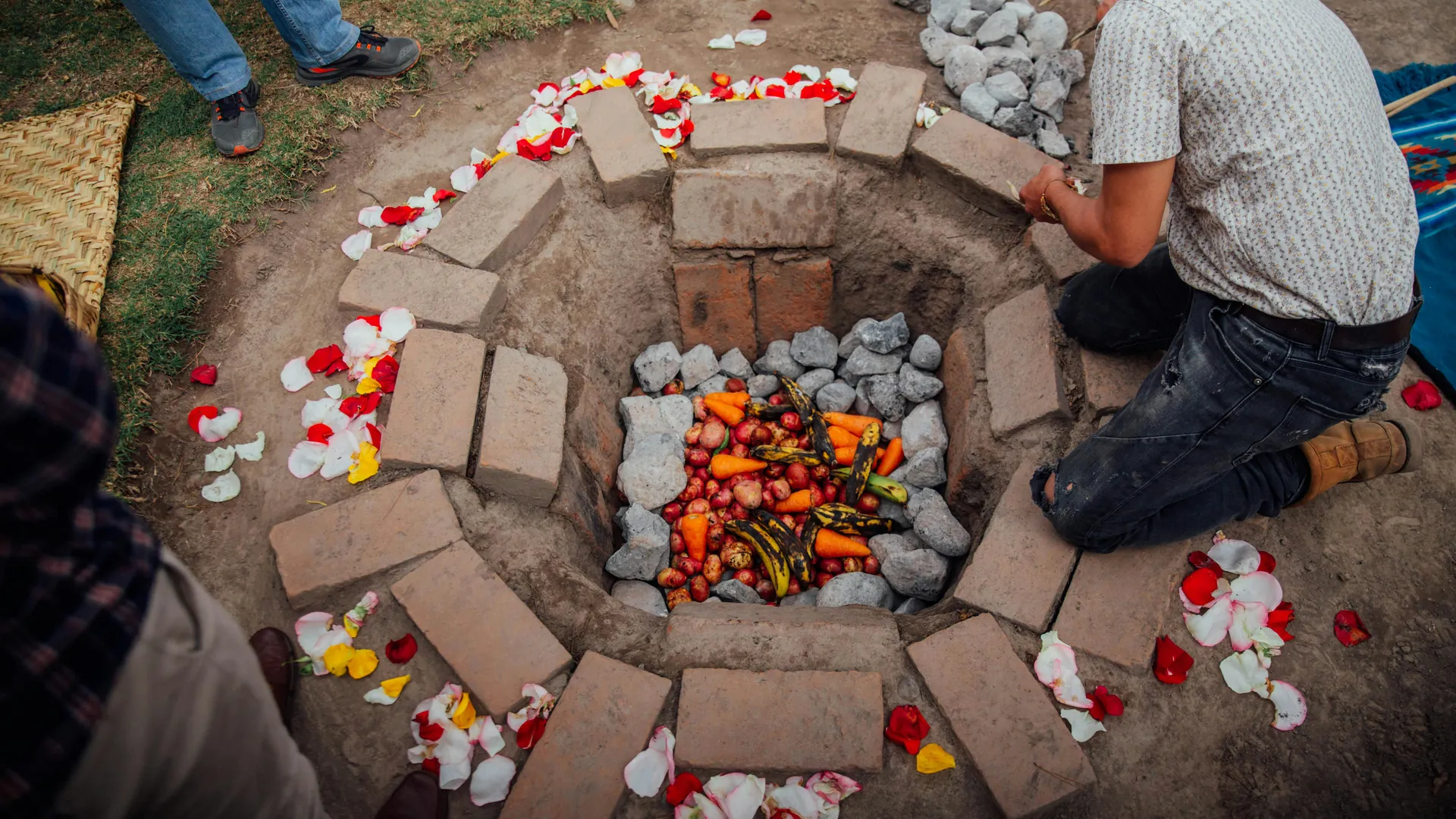
The trail network extends far beyond the immediate vicinity of the waterfalls, cutting deep into the forest to reveal sites of significant historical and spiritual importance. On the right-hand side of the main falls, a notoriously steep, slippery dirt spur trail leads hikers up to the Cueva Inti Raymi. This is a small, shallow ceremonial cave located near the top ridge of the waterfall. Historically, indigenous leaders have used this high vantage point for ritual purification. You can learn more about the specific history of these ceremonies in our breakdown of Andean Inti Raymi traditions.
Further along the forest perimeter loop, hikers will find the Piscina Incaica (Inca Pool). This thermal-mineral spring is located directly on the hiking route and maintains a steady water temperature between 19°C and 20°C (66°F – 68°F) year-round. While it lacks the extreme heat of volcanic hot springs found elsewhere in the country, it provides a highly therapeutic soak for tired leg muscles. Historical records maintained by Ecuador’s Ministerio de Turismo note that this specific pool was historically utilized by the wealthy Montúfar Barba family during the colonial era before being reclaimed by the local community.
For hikers looking to extend their cultural immersion after coming off the trails, the Hostal Aya Huma is located just a 20-minute walk from the main waterfall complex. This traditional indigenous-run lodge operates as a vital hub for pre- and post-hike wellness. They offer authentic Temazcal (sweat lodge) ceremonies and traditional Andean cooking workshops to visitors. If you want to explore more local crafts after your hike, read our guide to the local workshops and weavers operating near the trail exits.
Trail Accessibility & Hiking FAQ
Planning your trek through the Bosque Protector requires an understanding of local transport, fees, and terrain. Below are the definitive answers to the most common logistical questions regarding the trails.
- How do I get to the trailhead from Otavalo?
Hikers can catch a red public bus operated by the Cooperativa Imbaburapac, departing every 30 minutes from the Otavalo terminal. The 15-minute ride drops you near the forest entrance and costs exactly $0.35 to $0.50 per person. If you prefer specialized transport, booking a full-day private tour will include direct hotel pickup and drop-off at the registration gate. - Is there an entrance fee for the hiking trails?
While entry is famously considered donation-based, the local Faccha Llacta community explicitly requests a strict $0.50 minimum contribution at the trail registration desk. These funds directly finance the ongoing physical maintenance of the bridges, ziplines, and cobblestone paths. You can read more about how your entry fees support local ecology on our conservation and environment page. - How difficult is the hike to the main waterfall?
The primary route is highly accessible and requires minimal physical exertion. It consists of a flat, 1.5 km (0.9 miles) cobblestone path that takes roughly 20 to 25 minutes to walk at a leisurely pace. However, the secondary dirt paths—including the route to the 6-meter upper cascade—are steep, unpaved, and require navigating exposed roots at 2,592 meters above sea level. - Can you swim in the pools or the river?
Swimming directly under the main 18-meter cascade is highly discouraged due to the unpredictable, powerful currents of the Jatun Yaku River. Visitors looking for a safe thermal soak should hike to the Piscina Incaica located along the trail. This mineral spring maintains a steady, safe water temperature between 19°C and 20°C (66°F – 68°F). - Are there camping facilities inside the protected forest?
Yes, the official trail campground is located just to the left of the main entrance gate. It offers tent and basic cabin rentals coordinated through the visitor information center. The site also features a children’s zipline installed directly in the eucalyptus forest, making it a popular option for families exploring nearby regional attractions over a multi-day trip. - Is it safe to hike the trails alone?
The main cobblestone paths are heavily trafficked by domestic tourists and are very safe during daylight hours. However, solo hikers tackling the upper trails and caves should exercise physical caution due to the slippery mud and high elevation. We recommend reviewing our northern Ecuador safety guide for comprehensive advice on navigating the broader Imbabura province securely.