Hiking to El Lechero: The Sacred Tree
The Sacred Tree of Otavalo
The sacred El Lechero tree, scientifically classified as Euphorbia laurifolia, stands at an exact altitude of 2,845 meters (9,334 feet) atop the Pucará Rey Loma hill. For generations, indigenous communities have venerated this specific site. The original tree, estimated to be over 200 years old, held deep spiritual significance because its open branches naturally formed the shape of the chakana, or Andean cross. In early 2020, severe winds snapped the ancient canopy and destroyed the main structure of the tree. As of 2024, the remaining stump and the surrounding earth retain their highly venerated status, and local populations still consider the viewpoint’s energy deeply sacred.
Travelers actively mapping out a 7-Day Imbabura Itinerary prioritize this hike to experience the genuine 360-degree panoramic views from the summit. From the base of the tree, you can photograph the Imbabura Volcano, the Cotacachi Volcano, Lago San Pablo, and the rural agricultural communities of Quichinche and Otavalo in a single sweeping rotation. Understanding the sheer scale of the Imbabura province requires climbing above the valley floor. For broader geographical context before your arrival, Lonely Planet’s Otavalo guide offers essential background on the northern highlands.
Hike Logistics
Proper planning requires accurate data. The hike to El Lechero can be tackled as a direct ascent from Otavalo or as part of a larger, 12.4-kilometer loop that connects Plaza de los Ponchos, Cascada de Peguche, and Pucará Rey Loma. Review the logistical specifications below to determine the best approach for your physical fitness level.
| Metric | Specification |
|---|---|
| Distance (Direct Route) | Approximately 4 km (2.5 miles) one way from Otavalo center. |
| Distance (Full Loop) | 12.4 km (7.7 miles) connecting town, the waterfall, and the tree. |
| Estimated Time | 1.5 to 2 hours one way; 3 hours and 40 minutes for the full loop. |
| Elevation Gain | 330 meters (1,082 feet) from the valley floor to the summit. |
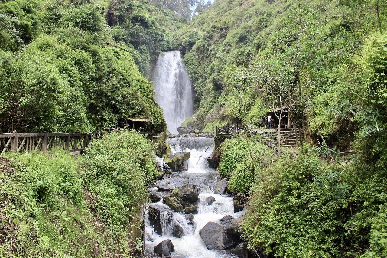
| Difficulty Level | Moderate. Requires a steep, near-vertical scramble if connecting directly from the 18-meter waterfall. |
| Transport Alternatives | Average taxi cost from Otavalo to the summit is $4.00. Local Imbaburapac buses cost $0.35 to the lower trailheads. |
The Legend of the Forbidden Lovers
The geographical features of the Imbabura province are inextricably linked to Kichwa mythology. The relationship between the towering tree and the massive lake below is rooted in a tragic history of rival indigenous families.
“To prevent them from uniting, the mountain gods cursed the lovers: Nina Paccha was transformed into the waters of Lago San Pablo, and Guayasamín was turned into the El Lechero tree, forcing him to watch over her waters for eternity without ever being able to touch them.”
Today, the viewpoint from the tree offers a sweeping look at the cursed maiden, Lago San Pablo. It is Ecuador’s largest natural lake, covering exactly 583 hectares with a maximum depth of 35.2 meters. The spiritual weight of this legend amplifies during the summer solstice in late June. Local Yachacs (shamans) conduct nocturnal purification baths in the specific waters feeding from the lake into the Peguche falls to prepare the community spiritually. You can learn more about these specific ancestral practices on our dedicated Kichwa Culture & The Inti Raymi Festival page.
Detailed Route Guide
Connecting the urban center of Otavalo to the rural heights of Pucará Rey Loma requires navigating distinct terrain changes. The route moves from paved streets to protected eucalyptus forests, ending on exposed agricultural dirt roads.
Starting in Otavalo
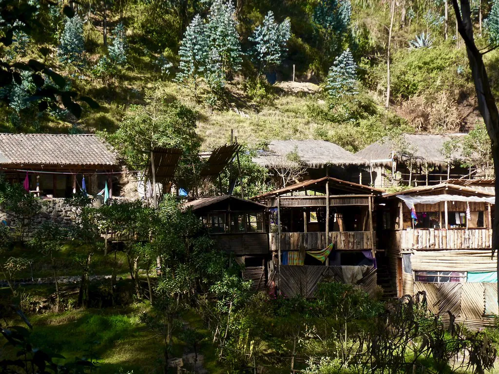
Independent hikers usually begin at Plaza de los Ponchos, heading south uphill via Piedrahita street. If you prefer to skip the urban walking segment, catch the blue buses run by the Compañía de Transporte Intraprovincial Imbaburapac at the main terminal. Buses depart every 30 minutes, cost exactly $0.35, and reach the Faccha Llacta community entrance in 15 to 20 minutes.
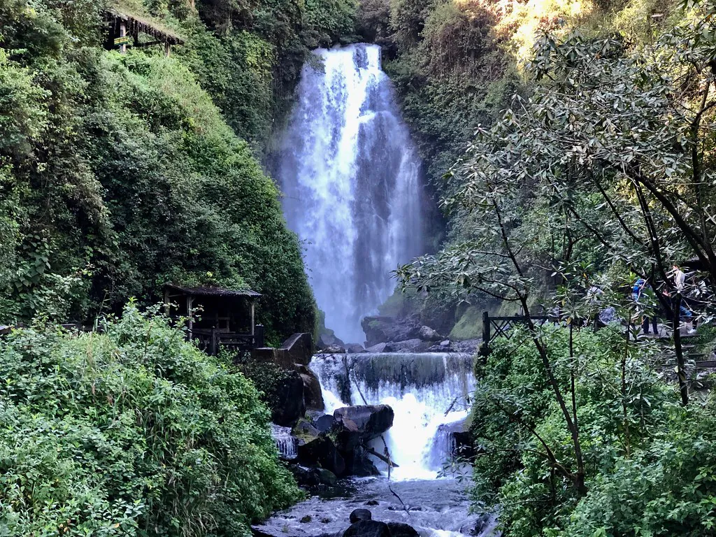
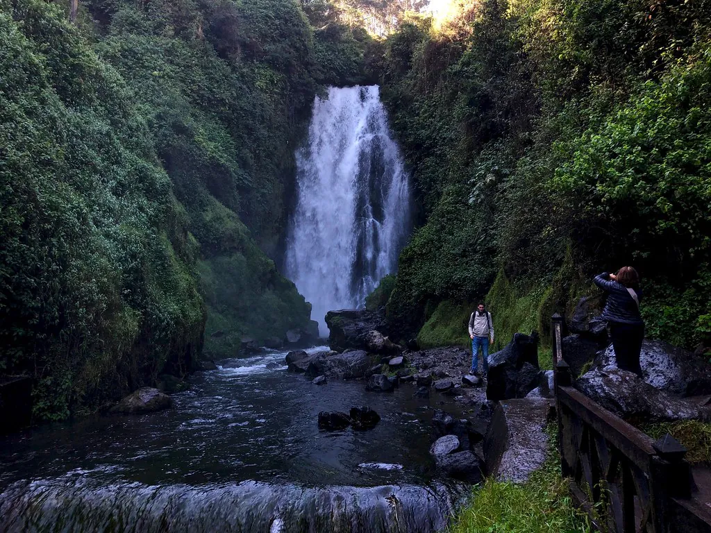
The Steep Trail Connection
To hike directly from Cascada de Peguche to El Lechero without looping back to town, you must traverse the Bosque Protector Cascada de Peguche. This 40-hectare eucalyptus forest is managed by the 127 indigenous families of Faccha Llacta. From the base of the falls, hikers face a steep, near-vertical scramble trail directly to the top of the 18-meter waterfall, which eventually flattens out.
Reaching the Summit
Once the trail levels off, it merges into a rural dirt road leading toward Parque Cóndor and Pucará Rey Loma. You will navigate unpaved switchbacks flanked by agricultural plots. Due to the isolation of the upper trails, review the Is Northern Ecuador Safe for Tourists? guide to understand current trail security protocols before beginning the final ascent.
Photography & Contextual Tours
Capturing the scale of the Imbabura and Cotacachi volcanoes requires precise timing. The cloud cover in the northern highlands typically increases by 11:00 AM. Photographers should reach the Pucará Rey Loma summit by 8:30 AM to secure clear, unobstructed shots of Lago San Pablo and the surrounding peaks. The morning light strikes the 583-hectare lake directly, eliminating the harsh shadows that complicate afternoon landscape photography.
For visitors operating on strict schedules, integrating this hike into a broader guided experience provides logistical efficiency. Travelers looking to maximize their time can book an Otavalo Adventure: Discover Kichwa Culture, Lakes & Crafts. This specific tour includes indigenous guides who explain the botanical history of the Euphorbia laurifolia and manage the complex navigation between the artisan markets, the waterfall, and the highland viewpoints.
After completing the descent, many hikers opt to rest and refuel near the water. Securing a table at the Puerto Lago Country Inn offers highly rated local cuisine directly on the shores of Lago San Pablo. Additionally, travelers planning further regional excursions should consult the Ecuador Tourism Board for up-to-date road conditions and seasonal route modifications across the Imbabura province.
Trail & Viewpoint Map
Use the map below to orient yourself before departing. The pins detail the starting point in Otavalo, the specific 40-hectare protected forest boundary, the steep connection at the top of the waterfall, and the final 2,845-meter summit at Pucará Rey Loma.